
Availability of cell phone signal and internet along the route
Mobile phone and internet connectivity on this trekking route is an important aspect for hikers, tour guides, and tourism operators. Because the route crosses high mountain areas, Andean valleys, and transitional zones toward the jungle, signal availability is very irregular and depends mainly on the proximity to towns or telecommunications infrastructure. In general terms, most of the trail has limited or nonexistent coverage, making the Salkantay Trek an experience of almost complete disconnection from the digital world.
Geographic features affecting the signal
The availability of mobile services on the Salkantay Trek is determined by the complex morphology of the terrain. The trails cross mountainous areas with steep slopes, canyons, and elevations that interrupt the propagation of radio waves. In sections where the terrain blocks the line of sight with antennas, coverage becomes intermittent or nonexistent. For this reason, signal usually appears only in open areas or near small towns, while in more isolated stretches, it is practically impossible to connect.
High altitude
One of the most relevant factors is the great elevation of the terrain. The highest point of the trek is the Salkantay Pass, located at approximately 4,650 meters above sea level. In high-altitude environments, weather conditions become more demanding: temperatures can drop considerably, winds are often strong, and precipitation can occur suddenly. These factors complicate the installation of telecommunication towers and other equipment necessary for signal transmission.
Additionally, transporting materials to these areas represents a significant logistical challenge. Many trekking areas can only be reached via footpaths or rural routes, increasing the cost and difficulty of developing technological infrastructure projects. As a result, communication systems at these altitudes are scarce and concentrated mainly near populated areas.
Natural terrain obstacles
The shape of the terrain also plays a fundamental role. This region is dominated by high peaks, steep slopes, and deep ravines that modify the path of radio waves used by mobile systems. When a signal encounters large rock masses or mountains, it can be absorbed, deflected, or weakened before reaching the receiving device.
This phenomenon explains why coverage can vary even over short distances. On a mountain peak, it may be possible to catch a signal for a few minutes, while a few meters down, inside a depression, the connection disappears completely. This irregular behavior is typical in mountainous areas where direct visibility with transmitting antennas is interrupted by the relief.
Distance from urban centers
Another element that conditions connectivity is the distance from cities or large towns. Along the route, there are small rural communities separated by long stretches of natural terrain. In these localities, technological infrastructure is usually basic and limited, as the demand for telecommunications services is relatively low.
The distance also implies that main transmission networks are several kilometers away. When the signal must travel such long distances through mountainous areas, its strength decreases considerably before reaching users. For this reason, hikers on the trek often experience extended periods without digital communication, especially in stretches located between communities or camps.
In summary, these aspects of the physical environment—the terrain’s altitude, complexity of the relief, and remote location—directly influence the quality and availability of mobile phone and internet services on this Andean route. These conditions explain why connectivity in the area is irregular and depends on specific geographic factors of the place.
Cellular signal coverage along the route
Mobile signal strength varies considerably depending on the trekking section. In areas close to small settlements or traveled paths, it is possible to catch coverage sporadically, while in remote areas or between mountains, the connection usually disappears completely. Service quality also depends on the height and orientation of the terrain, causing the signal to appear briefly and then be interrupted again in certain points.
Start of the trek
The starting point of the hike is usually near the towns of Mollepata or Challacancha, areas that still maintain some level of connection with mobile networks from nearby inhabited zones. In this initial stage, some hikers manage to catch signals from national operators, although intensity often fluctuates depending on the position within the valley or proximity to the road.
During the first kilometers, it is possible to find:
-
Irregular reception of mobile networks such as 3G or 4G
-
Opportunity to send text messages or make brief calls
-
Access to mobile data at reduced speeds
However, as the hike moves away from populated areas and enters higher terrain, the signal begins to weaken until it disappears in most of the route.
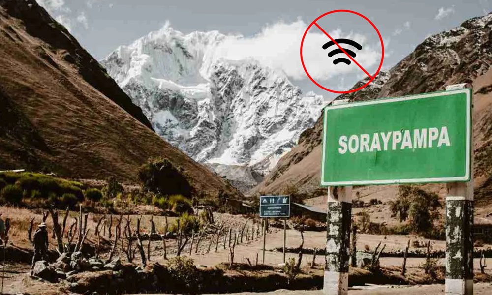
Soraypampa and Humantay Lagoon area
In the Soraypampa sector and the surroundings of Humantay Lagoon, sporadic moments of connectivity may be recorded. This phenomenon occurs mainly in open areas or elevated points where the phone can catch signals from antennas located in more distant inhabited areas.
Some visitors mention that in certain places it is possible to:
-
Make calls in case of emergency
-
Send photos or short messages
-
Use mobile data in a limited way
Even so, service quality is usually very variable. The signal may appear for a few minutes and disappear again after moving a few meters, which reflects the typical instability of communications in mountainous environments.
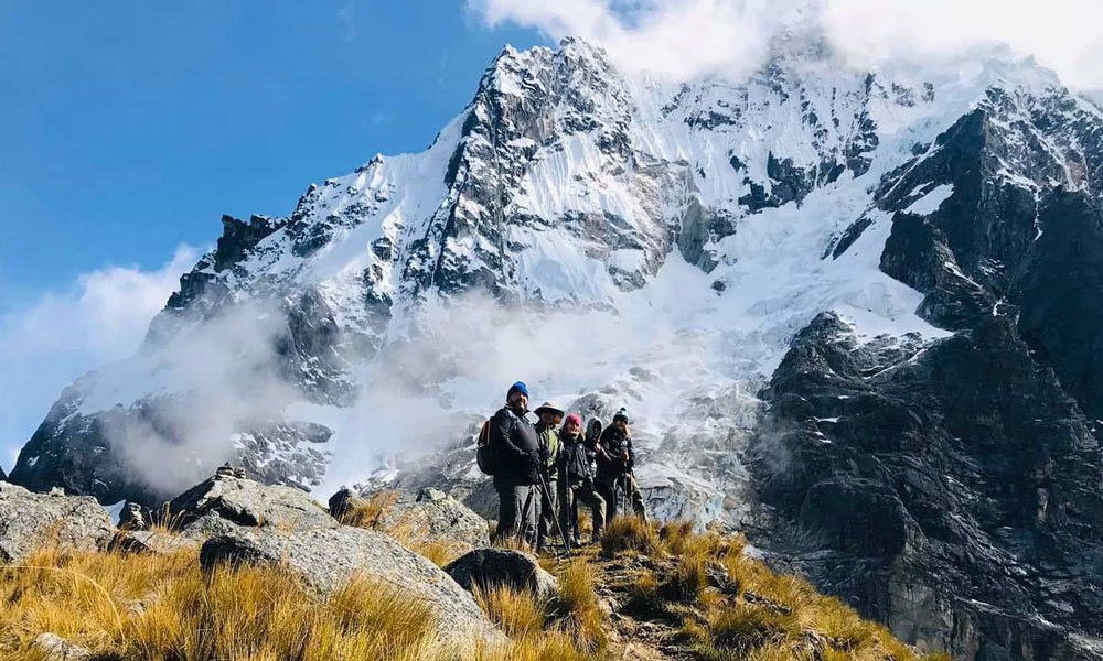
High mountain sections
After leaving Soraypampa, the trail ascends to the Salkantay Pass, one of the highest sectors of the entire route. In this part of the trek, mobile coverage practically does not exist.
The absence of connection is explained by several factors, including:
-
The high altitude of the mountain pass
-
The distance from telecommunication infrastructures
-
Severe weather conditions that make equipment installation difficult
During this stage, hikers are usually completely disconnected from any phone network. For many travelers, this situation represents an opportunity to focus fully on the trekking experience and the natural surroundings.
Descent toward the high jungle
After crossing the mountain pass, the path continues toward lower areas such as Chaullay and Lucmabamba. In these areas, altitude decreases, and small towns with basic infrastructure begin to appear.
Thanks to the proximity of these communities, some places offer:
-
Enough signal to make simple calls
-
Access to mobile internet with limited speed
-
Wi-Fi networks in accommodations or tourist camps
Although connectivity may still be irregular, the service is more frequent than in high mountain sections.
End of the route
Coverage improves considerably when hikers arrive at Aguas Calientes, a tourist town located at the foot of the Machu Picchu Historic Sanctuary. As it is a destination heavily visited by travelers from around the world, this town has more developed telecommunication infrastructure.
At this point, it is possible to find:
-
Stable mobile phone service
-
Internet connection in hotels, restaurants, and cafés
-
Wi-Fi networks available in several establishments
For this reason, many hikers take advantage of their arrival to restore communication with family, share photos of the trek, or update social networks after several days of walking in areas with limited connectivity.
Mobile operators with the most coverage
In Peru, there are four main mobile phone companies:
-
Movistar
-
Claro
-
Entel
-
Bitel
Among them, Movistar and Claro usually have greater coverage in rural areas of the country.
However, even with these operators, signal along the trek remains limited due to the geography of the area.
Internet availability during the trek
Along the route, digital connection is quite limited. Online communication depends mainly on two resources that can be found in some sections of the trail. These means allow, in certain moments, performing basic online activities, though with many technical restrictions.
The two elements influencing the possibility of connecting are:
-
Data networks from phone companies
-
Wireless systems installed in lodgings or rest areas
Mobile internet
In much of the hike, using data from the phone is practically impossible. The main reason is the distance between the mountain trails and the telecommunication towers located in nearby towns. Therefore, devices cannot catch sufficient signal intensity to send or receive digital information.
In some elevated points, connection may appear briefly; however, transfer capacity is usually minimal. When this occurs, hikers generally can only check notifications or send simple messages. Applications requiring higher speed, such as video calls or file downloads, almost never work correctly under these conditions.
Wi-Fi in camps
In certain sections of the trail, some rural lodgings or tourist camps offer wireless access to visitors. This service usually operates via satellite technology or other link systems installed specifically for remote areas.
The most common features of this type of connection are:
-
Reduced speed due to the limited capacity of the system
-
Restricted usage time to avoid network saturation
-
Usage mainly focused on basic messaging
In several camps, access has an approximate cost of 10 soles per session, allowing travelers to briefly communicate with family or report their progress. However, performance is usually not sufficient for activities that require higher data consumption.
Main reasons for low connectivity
The scarce availability of cellular signal is explained by several factors related to geographic location, environmental conditions, and restrictions for developing technological infrastructure.
Limited infrastructure
Telecommunication towers are usually installed mainly in cities, populated centers, or roads with high human traffic. In rural and hard-to-reach areas, building these structures requires higher economic investment, specialized equipment transport, and constant maintenance. Due to these costs, many mountainous areas lack nearby repeater stations, significantly reducing mobile coverage.
Weather conditions
High mountain climates present intense meteorological phenomena that can affect the functioning of technological equipment. Heavy rains, low temperatures, snowfalls, and strong winds generate wear on transmission systems and increase the risk of technical failures. These conditions also make repair or maintenance work difficult, discouraging the installation of new telecommunication structures.
Environmental protection
Much of the territory crossed by the trek corresponds to natural areas where measures exist to preserve the landscape and biodiversity. Environmental protection regulations limit the construction of infrastructures that could alter the ecosystem or affect the scenic value of the surroundings. As a result, the development of technological networks remains restricted in several areas of the region.
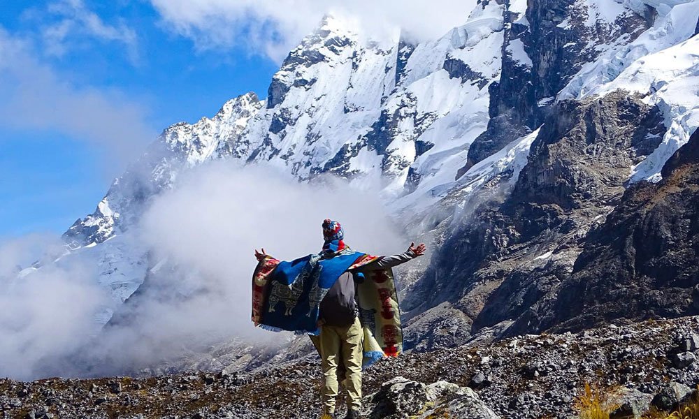
Digital disconnection experience
The lack of electronic communication becomes a distinctive element of this hike, appreciated by those seeking to get away from technological routine.
Hikers take advantage of this time to focus on aspects that often go unnoticed in daily life:
-
Contemplate local biodiversity and ecosystems
-
Appreciate panoramas of mountains, valleys, and glaciers
-
Strengthen interaction with travel companions and guides
-
Experience the physical challenge and personal endurance required by the trek
For many guides, the absence of signal allows visitors to live the route with greater mindfulness, enjoying each moment without digital distractions and connecting directly with the natural surroundings.
Recommendations for hikers
Considering the limited connectivity, it is advisable to adopt measures that ensure safety and comfort during the hike.
Inform before starting the trek
It is recommended to notify family or trusted people about the trip, specifying that communication will be intermittent or nonexistent for several days.
Download offline maps
Having navigation apps that work without connection allows orientation on trails, identification of landmarks, and route planning without depending on the internet.
Carry extra battery
Having portable chargers or power banks ensures that essential electronic devices can remain operational, especially in camps where there is no access to electricity.
Use radios or guide communication
Tourist agencies usually equip the group with radios or satellite phones for emergencies, ensuring that help can be requested even in areas without mobile coverage.
Mobile phone and internet availability on the Salkantay Trek is very limited for most of the route. Connectivity only appears in some points near towns or camps, while in high mountain areas, the signal usually disappears completely. At the end of the trek, in Aguas Calientes, telecommunication services return to normal.