
Vilacota Maure Regional Conservation Area
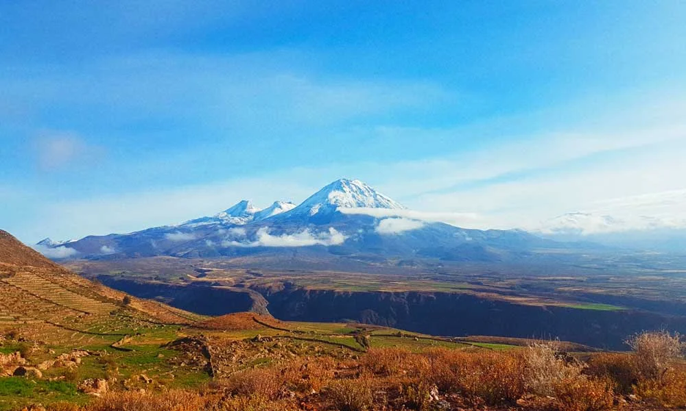
The conservation area is located in the province of Tarata and Candarave, which belongs to the Tacna region (Peru). It covers an area of 124,313.18 hectares, encompassing the districts of Tacna, Tarata, Susapaya, Ticaco, and Candarave. Its objective is the conservation of wild flora and fauna, as well as the conservation of the Maure and Laguna Vilacota rivers. The populations in the area are mainly engaged in camelid livestock farming.
FLORA: In Vilacota Maure, we find a very diverse flora of 124 species, such as queñua forests, tolares, bofedales, grasslands, among others.
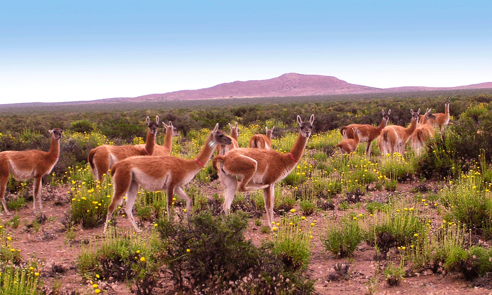
FAUNA: Some are vulnerable and others are endangered, such as the Suri, the taruca, the vicuña, and others.
The most notable species in the area is the Suri or ñandu, a species that only inhabits South America, specifically the regions of Tacna, Moquegua, and Puno.
This ecosystem features beautiful lagoons such as Vilacota, Taccata, Ñeque, Camiri, and Paucarani.
Natural attractions represented by the Vilacota Maure Regional Conservation Area
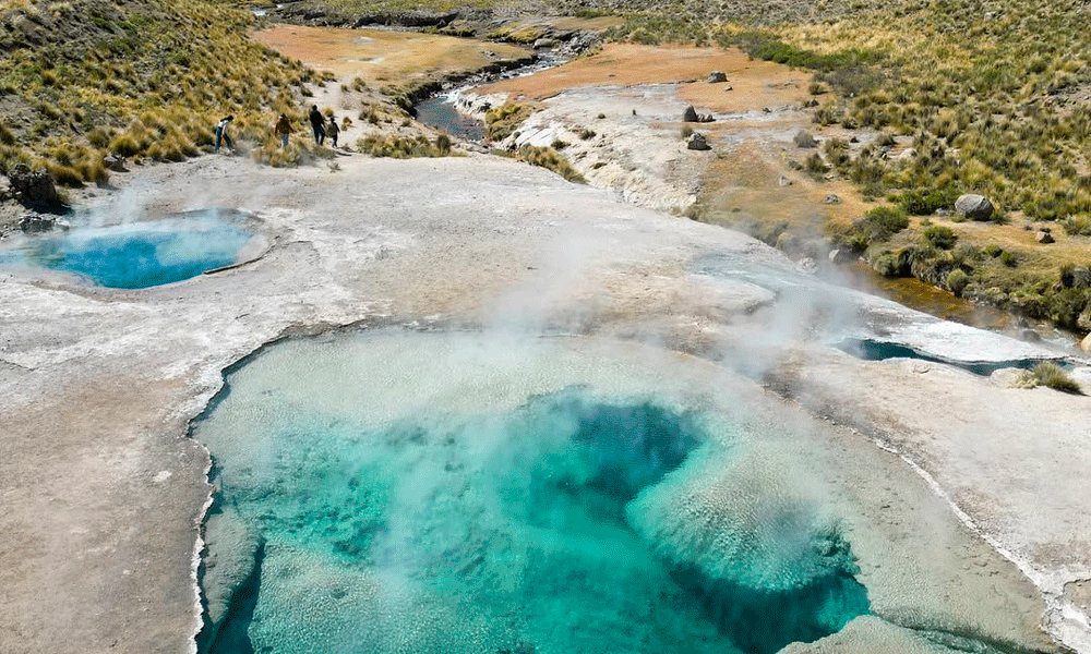
VALLEY OF THE GEYSERS: Located at 4300 meters above sea level, this valley is home to 85 hot springs, the main one being Laguna Azul. Temperatures range between 37° and 80° and are attributed with incredible healing properties. In this incredible place, you can cross the trapezoidal bridge and observe geological formations, such as the most popular one, the elephant rock.
- GEYSERS OF COTA OR GARGANTA DEL DIABLO
Located in the province of Candarave, in the Vilacota Muare Conservation Area at an altitude of 3,800 meters above sea level. This place is accessible for trekking, starting at the Huiltavira trail to Kalachupalne. Upon arrival, you will find rock formations where geysers expel hot water and gases into the sky, which form streams of hot springs as they fall. - CONCHACHIRI WATERFALLS
Located in the province of Tarata, in the village of Kallapuma at 4500 meters above sea level, near the imposing Jacuri snow-capped mountain, guardian of the area. The waterfall has a beautiful drop due to the deformations of the earth’s crust. The locals practice artisanal fishing, especially for trout. - CALACHACA WATERFALLS
Located at 4300 meters above sea level, in the district of Ticaco, province of Tarata. This incredible geological formation is the Calachaca waterfalls, also known as the skull. They are located very close to the hot springs. - CONDORPICO LAGOON
It is surrounded by the Apus and vegetation, where yareta, tola, ichu, and queñua grow. From January to March, the vegetation is a paradise, a place where birds descend to rest, including various species of ducks. - VILACOTA LAGOON
Located 187 km northeast of Tacna, near Puno and at an altitude of 4300 meters above sea level. It enjoys great natural resources, and the species that inhabit it are rainbow trout, ideal for fishing. The place is surrounded by geysers and snow-capped mountains.
Cultural Attractions
- JUKURI CEMETERY: This cemetery dates back to the Inca period and is currently in fair condition.
- PAMPAS MAMUTA HUNTING AREA: This territory has an extensive plain of wetlands, suris, vicuñas, and a variety of birdlife. It is said that this place was the scene of hunters and gatherers during the Lithic period. Arrows and other stone artifacts have been found here.
- CHULLPAS DE CONCHARIRI: This is a funerary structure made of mud and straw in poor condition that may date back to the Inca period.
- CAMINO INCA VILACOTA: This was the route used to connect all the towns ruled by the Incas with the capital of Tawantinsuyo, Cusco.
How to get to the Vilacota Maure ACR?
Access from the city of Tacna to the conservation area is only possible by land, which is about 188 km or 3 hours away. You have to rent a vehicle, have your own vehicle, or opt for a tour from a travel agency.
ACCESS ROUTES
- Tacna – Tarata – Livini – Vilacota (200 km – 3 hrs)
- Tacna – Tarata – Candarave – Calientes (260 km – 4 hrs)
- Tacna – Palca – Alto Peru – Chiluyo – Vilacota (183 km – 4 hrs)
- Tacna – Tarata – Susapaya – Cano – Vilacota (182km – 3 hrs)
- Tacna – Locumba – Ticapampa – Cadarave – Calientes (260km – 5 hrs)
- Puno – Capazo – Challapalca – Vilacota (293km – 4 hrs)
- Ilo – Moquegua – Huaytiri – Vilacota (492 km – 6 hrs)
Vilacota Maure Regional Conservation Area
Tours in Cusco